|
OLD PLYMOUTH
. UK |
||
|
© Brian
Moseley, Plymouth Webpage created: April 25, 2021 Webpage updated: April 25, 2021 |
||
|
|
||
|
ROADS AND STREETS IN OLD PLYMOUTH LOWER LANE
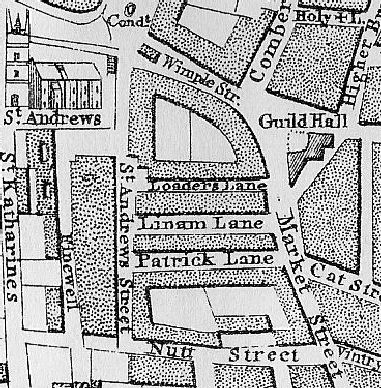
At the time of Benjamin Donn's map of Plymouth in 1765 Lower Lane was called Patrick Lane.
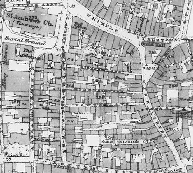
By the 1860s it had become Lower Lane. Lower Lane was one of three thoroughfares that ran between Saint Andrew Street to the west and High Street (formerly Market Street) to the east. The others were appropriately named Higher Lane and Middle Lane. Lower Lane should not be confused with Lower Street. Simply, it was the lowest of the three Lanes between Saint Andrew Street and High Street, formerly Market Street). During the 1860s and 1870s Plymouth Corporation made a number of street improvements in this area. It demolished the eastern side of Saint Andrew Street and widened it. This impacted especially on Lower Lane, which got widened and rebuilt as Palace Street. As a result Middle Lane took over the name Lower Lane.
|
||