|
OLD PLYMOUTH
. UK |
||
|
© Brian
Moseley, Plymouth Webpage created: April 26, 2021 Webpage updated: April 26, 2021 |
||
|
|
||
|
ROADS AND STREETS IN OLD PLYMOUTH HIGH STREET
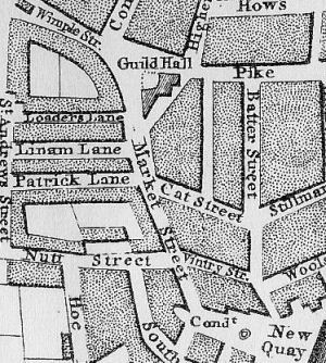
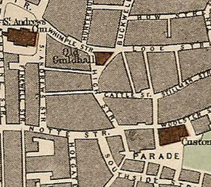
The roadway that was to become High Street was shown on Benjamin Donn's map of Plymouth in 1765 as Market Street.
High Street in the 1890s. High Street, Plymouth, ran from Whimple Street southwards across Stillman Street and Woolster Street to The Parade. 'Hygh strete' was recorded in Plymouth in 1493 but had apparently become 'Marget Street' by 1537. High in the context of a street name means "main". As each settlement in Britain grew the roads between them became "high ways" while the main street where the businesses established themselves became known as the "high street". They were often the first part of a town to get a pavement to separate the people from the traffic. In some towns - like Plymouth Dock / Devonport, the name "Fore" was used instead. The only prominent building in the Street was the Palace Court Board School, later the Palace Court Elementary School, on the eastern side, on the corner with Stillman Street. A block of Corporation flats was erected in High Street in 1937.
Numbers 19, 20 and 21 High Street, Plymouth,
in 1942. The well-known local business of Messrs James L Nash, potato merchants, was at number 34 High Street, on the Parade side of Notte Street. For the Occupants of High Street in 1890 CLICK HERE.
|
||