|
OLD PLYMOUTH
. UK |
||
|
© Brian
Moseley, Plymouth Webpage created: April 25, 2021 Webpage updated: April 25, 2021 |
||
|
|
||
|
ROADS AND STREETS IN OLD PLYMOUTH HIGHER LANE
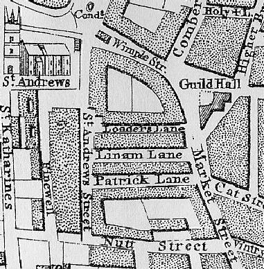
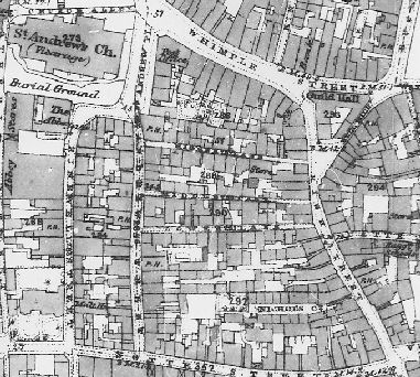
At the time of Benjamin Donn's map of Plymouth in 1765 Higher lane was called Loader's Lane.
By the 1860's it had become Higher Lane. Higher Lane was one of three thoroughfares that ran between Saint Andrew Street to the west and High Street (formerly Market Street) to the east. The others were appropriately named Middle Lane and Lower Lane. Higher Lane should not be confused with Higher Street. The origin is simply because it was the higher of the three Lanes.
|
||