|
OLD PLYMOUTH
. UK |
||
|
© Brian
Moseley, Plymouth Webpage created: January 29, 2019 Webpage updated: March 20, 2020 |
||
|
|
||
|
ROADS AND STREETS IN OLD PLYMOUTH - A-Z INDEX TAVISTOCK ROAD, PLYMOUTH
Old Town Street ended at the Old Town Gate in
1765, Since time immemorial (or July 6th 1189 if you want to be precise) there has been a highway between Sutton and the "Stock" on the river Tavy.
By 1820 Old Town Gate had gone but the Conduit
was still in place.
The Borough Free Library and Museum
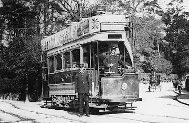
Looking northwards up North Hill, Tavistock
Road.
The Revenue Hotel, number 12 Tavistock Road,
on the corner of Duke Street, August 1958.
Looking south down Tavistock Road, with Spear's Corner
and Old Town Street to the right, October 1958.
Between the photograph above and the one below
were
Looking south down Tavistock Road at the Harvest Home
Public House
Opposite the City Museum were these temporary shops,
Tavistock Road at the junction (right) with
Ebrington Street, 1950s.
Numbers 6, 7, 8 and 9 North Hill Terrace in
post-war Tavistock Road, June 1954. In the 1850s the stretch between Saltash Street on the western side and Ebrington Street on the eastern northwards as far as Pound Street and Tavistock Place was known as Tavistock Street. Tavistock Road extended from the end of Old Town Street through Mutley Plain in to the Civil Parish of Compton Gifford and eventually to the Borough of Tavistock. For a list of the Occupants of Tavistock Place, Plymouth, in 1889 CLICK HERE. For a list of the Occupants of Tavistock Road, Plymouth, in 1889 CLICK HERE. For a list of Occupants of Tavistock Street, Plymouth, in 1852 CLICK HERE.
|
||